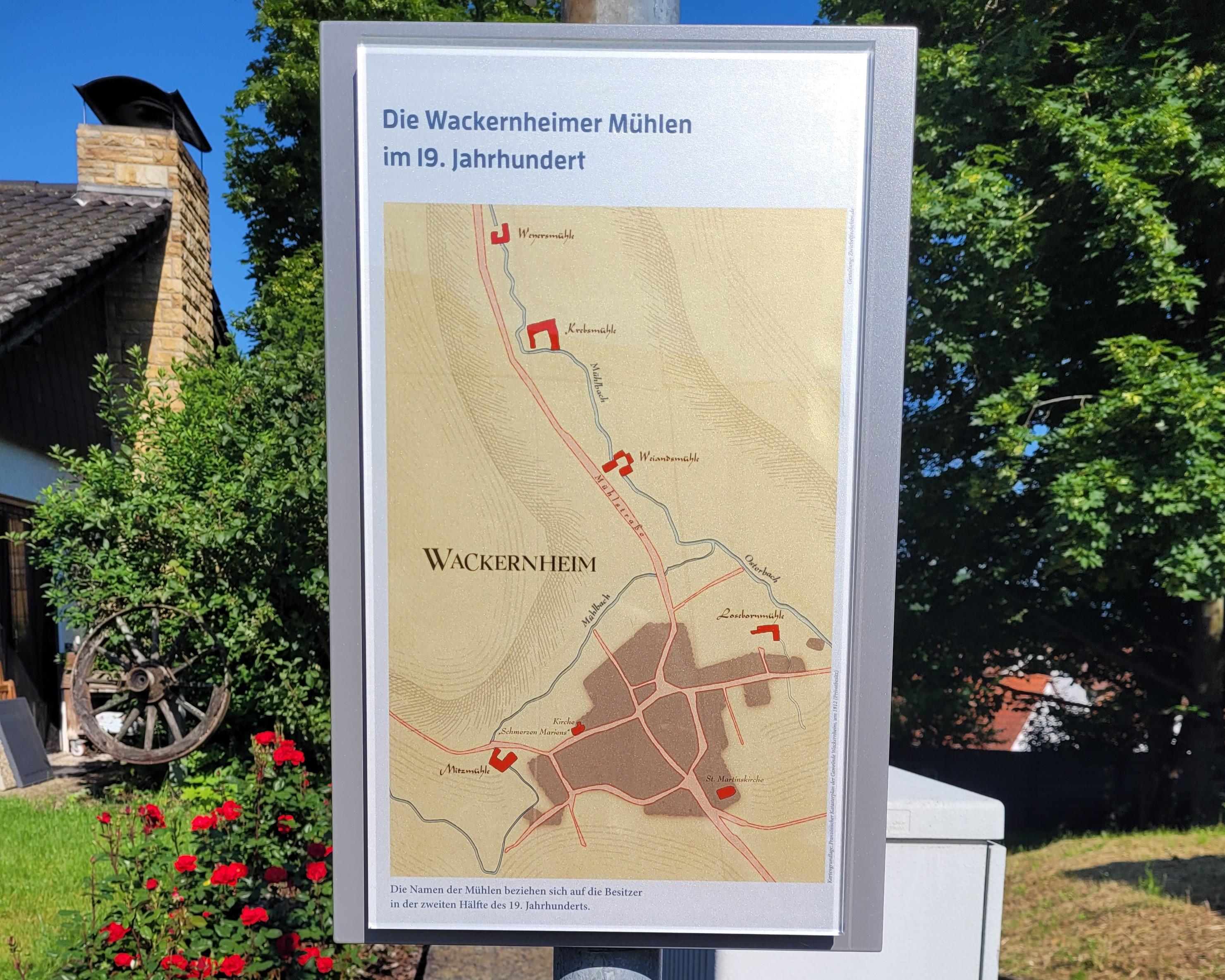
Where today the street "An der Bachwiese" runs, the mill stream used to flow. This was an artificially created watercourse, fed by the springs on the Neuberg and in the Großen Wiese. It powered the waterwheel of the Mitzmühle and then crossed the Hasselstraße. Beyond the Mühlstraße, it united with the Osterbach. The water power of this stream then served the mills of the three lower mills. Additionally, the water from the nearby springs was utilized. All Wackernheim mills were driven by overshot waterwheels.
Until the middle of the 20th century, all millers had ceased their operations. The bed of the mill stream dried up after the spring water was diverted into a canal in 1965.
By the way: In April 1876, the floods of a major storm caused significant damage to the lower Wackernheim mills. In Heidesheim, the waters claimed eight lives.